

Online Maps of Combat Operations: A Review of the Best Resources for Frontline Analysis

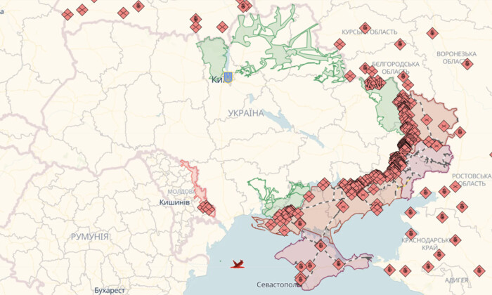
The 'Glavcom' website has prepared a very interesting selection of online maps of combat operations in Ukraine. This will help us better understand what is happening at the front, where the fighting is taking place, and how the Armed Forces of Ukraine are gradually liberating our territories.On the first map, Deep State Map, we can see various conditional markings – blue indicates territories liberated in the last two weeks, green – liberated territories, gray – territories that need clarification, red – territories occupied by the Russians, dark red – Crimea and ORDLO, light red – occupied territories of other states. It also shows railways, units, headquarters, airfields, and enemy attack directions.In addition, there are two more maps – Liveuamap and ISW (Institute for the Study of War), which also show conditional markings and important military objects. These maps help us visually understand the situation at the front and our victories in the war.Let's all remain vigilant, relying only on credible sources and official messages. Together, we will overcome the enemy and be able to return our country to peace and prosperity.

Read also