

First Images and Data from Copernicus Sentinel-3C Confirm Satellite’s Operational Success

Sentinel-3C Satellite Launch Update
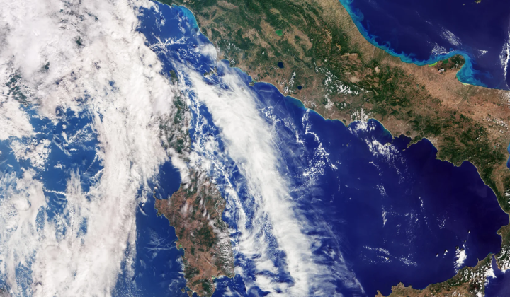
According to НВ — Техно: Two weeks after its launch, the Copernicus Sentinel-3C satellite has transmitted its initial images and scientific data, confirming that it is functioning as intended. The European Space Agency has reported successful image captures over regions including Italy, the Canadian Arctic Archipelago, and the Caribbean Basin. Additionally, the satellite gathered altimetric measurements of Greenland’s ice cover and sea surface.
Preparations to fully commission Sentinel-3C will continue for another five months. As the third satellite in the Sentinel series, it plays a crucial role in monitoring environmental parameters such as:
- temperature measurements
- color analysis
- sea level monitoring
Beyond these tasks, Sentinel-3C tracks drought conditions, wildfires, and the cryosphere’s health. Its data reinforce evidence of the ongoing rise in global sea levels, currently increasing at a rate of 3.64 millimeters per year since 1999.
The Impact of Sentinel-3C’s Data
The measurements align closely with data from other missions, demonstrating the reliability and precision of Sentinel-3C’s observations. This satellite will enhance our ability to understand environmental changes and support efforts to mitigate the effects of climate change.
The launch of Sentinel-3C marks a significant advancement in global environmental monitoring systems.
The information provided by Sentinel-3C is vital for improving natural disaster forecasting and climate adaptation strategies. With rising ocean levels and more frequent extreme weather events, accurate satellite data are becoming indispensable for scientists and policymakers addressing these urgent global challenges.

Read also