

Meteomatics’ Strato Drone Sets New Altitude Benchmark by Reaching 10,438 Meters to Gather Weather Data

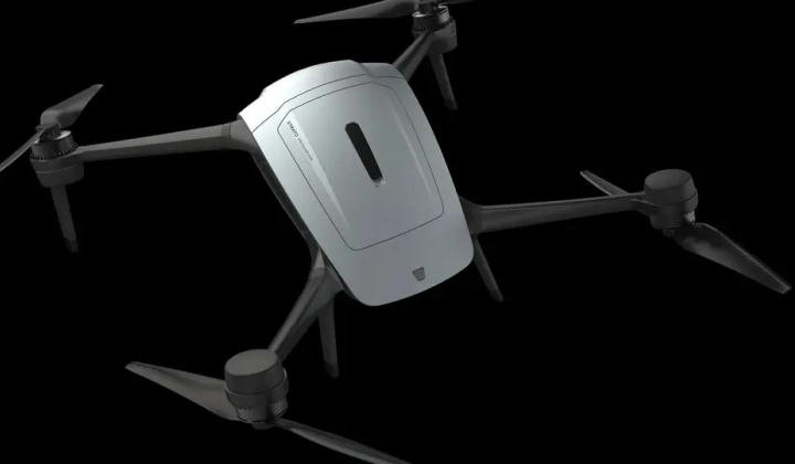
Introducing the Strato Drone from Meteomatics
According to НВ — Техно: Swiss-based Meteomatics has unveiled its latest innovation: the Strato multicopter drone, which has successfully ascended to an altitude of 10,438 meters. Designed to collect atmospheric data from ground level up into the stratosphere, this drone is equipped with anti-icing technology, can operate in winds reaching speeds of up to 128 km/h, and follows predetermined flight paths with autonomous return capabilities. Strato aims to address gaps in meteorological data collection caused by the limitations of traditional weather balloons.
Features and Intended Use
The Strato drone is engineered to measure key atmospheric parameters including:
- temperature
- humidity
- air pressure
- wind speed
Its aerodynamic design, wind control systems, and waterproof build enable it to transmit telemetry data in real time throughout its flight. While this represents a significant technological achievement, Meteomatics has yet to disclose details such as battery capacity, flight duration, payload weight, or the exact conditions under which the maximum altitude was reached.
Currently, meteorological balloons equipped with radiosondes remain the primary method for high-altitude atmospheric measurements. However, these balloons are typically launched on fixed schedules, resulting in data gaps. Strato offers the flexibility to gather weather data at specific locations and times, enhancing the accuracy of forecast models like US1k and Euro1k.
In a separate development, on October 9th, China achieved a world record for the coordinated autonomous operation of 116 underwater drones in a pool. These drones covered approximately 500 meters over 34 minutes while maintaining synchronized movement. The project involved collaboration between Northwestern Polytechnical University and Xian Tianhe Maritime Technologies.
Dr. Martin Fengler from Meteomatics commented: 'A decade ago, a drone capable of efficiently flying into the stratosphere to collect meteorological data was merely a dream. Today, we have made that dream a reality.'
The advancement of unmanned aerial systems like the Strato drone opens new frontiers for atmospheric data gathering, which could significantly enhance the precision of weather forecasting. As climate change drives more extreme weather events, reliable monitoring of atmospheric conditions is increasingly critical. Initiatives such as Strato reflect the commitment of scientists and companies to harness innovative technologies to deepen our understanding of climate dynamics.

Read also